Cape Disappointment State Park
We almost skipped Cape Disappointment State Park on our trip to the northern Oregon and southern Washington coast. “It sounds sad,” was my husband’s concern. But we needed someplace to stay between Astoria and Grayland Beach, so we decided to give it a try. It turned out to be the highlight of the trip! We even stayed an extra day, and enjoyed a simple Thanksgiving meal from our space in the campground.
Located on the Washington side of the Columbia, Cape Disappointment State Park has fantastic views of the river mouth, an Interpretive Center, two lighthouses, and miles of rugged Pacific Northwest beaches. There were few visitors during our stay in November, but a campground employee told us it would be bumper-to-bumper cars in the summer and that people booked months ahead to get a campsite. Seems like we are not the only ones who find this a wonderful place to vacation.
Love lighthouses?
Check out the Oregon Coast Lighthouse Roundup.
Loop overlook
25 Steps

At this scenic turnout en route to Cape Disappointment you can enjoy the cape from a distance, and read the sign about shipwrecks at the mouth of the Columbia. It’s worth a stop to get an overview of the landscape and coastline just north of where Columbia River mingles with the Pacific, and to become acquainted with the grim history of the region.
| Terrain: Flat pavement and sidewalk |
| Seating: None |
| Fee: No |
| Restrooms: No |
| Directions: North Head Road is a one-way loop off Highway 100. The overlook is north of the campground entrance, very easy to spot off the road. |
Waikiki Beach
25 Steps
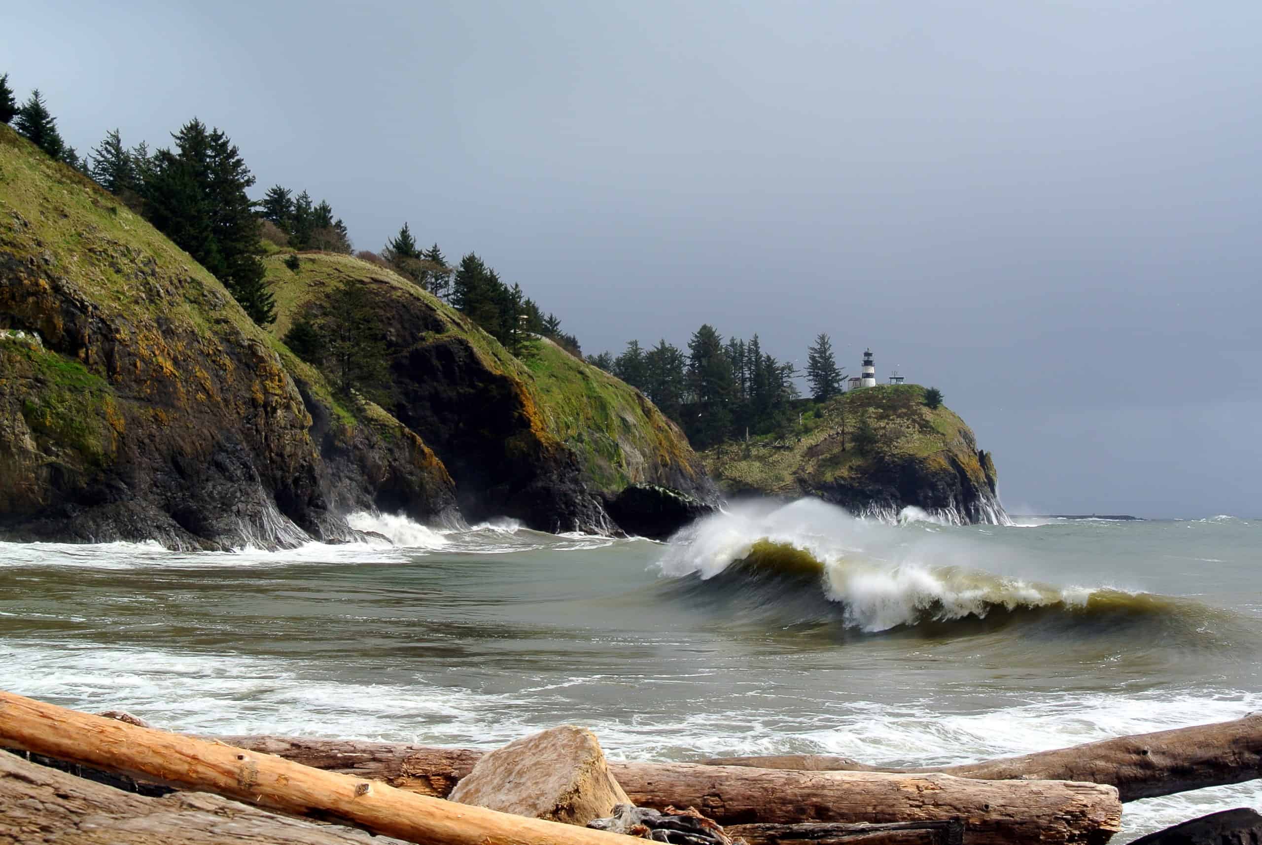
This rubble-strewn, crescent Columbia inlet is not at all reminiscent of its Hawaiian namesake. Documented as the only waters with marginally safe swimming in the vicinity, even the surfers were not braving it during the winter storm raging on the day of our visit. Over the driftwood (large felled trees…not the small kind you can collect!), you can watch waves splashing against the tall cliffs on the beach’s far side. The striped Cape Disappointment lighthouse overlooks the entire area. Nearby signs cover how the beach got its name, and tout it as the end of the Lewis and Clark trail.
| Terrain: Weathered parking lot and somewhat uneven grass. Debris blocks access to the beach. |
| Seating: Several picnic tables are scattered in the grass. |
| Fee: Day pass, recreation pass, or camping receipt |
| Restrooms: No, although there are some opposite the larger parking lot passed on the drive in. |
| Directions: Just south of the campground entrance, take Jetty Road past the large parking area on the right to a long narrow parking lot paralleling the beach. |
Campground beach view
50 Steps
During the wet timeframe of our stay, the campground B loop was partially closed due to flooding. But while exploring we located a short trail to the beach next to campsite 104. While watching the churning surf in our raingear, we met a local gent who had come to watch a wooden fishing boat that had been on shore long enough to be included in the campground signs. He was convinced it would be washed away in the high storm surf of the day. He was right! We did not actually see it get swept back to sea, but the boat was present in the morning and absent by our repeat visit in the afternoon. It’s awesome to witness the power of the sea.
From the end of this path, in addition to the ocean and detritus-strewn shores, North Head Lighthouse is visible to the north.
| Terrain: Sand trail, mostly flat but may be obscured by driftwood washed up from the ocean. A large swath of debris blocks access to the beach. |
| Seating: None |
| Fee: Day pass, recreation pass, or camping receipt |
| Restrooms: In campground |
| Directions: Park as close as you can to campsite 104 in the B loop of the campground. The trail is next to this site. |
Interpretive Center overlook
100 Steps
My husband and I had been on a quest for a bird’s eye view of the Columbia River mouth for our entire trip, and of all the places we stopped the vantage from the Lewis and Clark Interpretive Center walkway was the only one that actually quenched our sight-based thirst. From here, we were rewarded with a sublime look at the mouth of the Columbia River gaping toward the open ocean while waves rolled along the jetties on either side and crashed against the cliffs below. Seabirds darted below more so than above, and a couple of hardy surfers seeking storm swells glided on the long rollers travelling inland. In addition to the river and sea sights, the Cape Disappointment Lighthouse was close to the south on a bluff of similar height, warning incoming ships of the headland on which it rests.
Note: The Interpretive Center was closed during our visit, so I have no information on the Center itself.
| Terrain: Wide pavement and smooth sidewalk walkway. Incline from parking until it levels out around the Interpretive Center. |
| Seating: None that I saw, although it was pretty stormy so I did not walk the length of the walkway. |
| Fee: Fee for admission to the center. No fee for the view. |
| Restrooms: Inside the Center |
| Directions: The Interpretive Center has two parking lots: A lower lot that has a very steep path, or an upper lot reached from a one-lane road that requires a disabled parking permit. The step count is from the upper lot. I would not have been able to negotiate the general-use path to the Center. |


